Start at: 15215 Barranca Pkwy Irvine, CA 92618
1. Head northwest on Barranca Pkwy toward Ada - 0.5 mi
2. Slight left to stay on Barranca Pkwy - 0.7 mi
3. Turn right at Irvine Center Dr - 3.6 mi
4. Turn right at Culver Dr - 0.1 mi
5. Slight left toward Culver Dr - 348 ft
6. Slight right at Culver Dr - 2.4 mi
7. Turn right at Irvine Blvd - 5.3 mi
8. Slight left to stay on Irvine Blvd - 1.0 mi
9. Turn left at Bake Pkwy - 3.0 mi
10. Turn right at Portola Pkwy - 1.6 mi
11. Continue on Santa Margarita Pkwy - 0.7 mi
12. Turn right at Marguerite Pkwy - 1.5 mi
13. Turn left at Tres Vistas - 39 ft
14. Turn right at Marguerite Pkwy - 1.3 mi
15. Turn left at Trabuco Circle - 243 ft
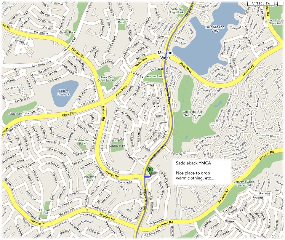
Rest Stop - 22 Miles (Map Link)
Saddleback YMCA
16. Head west on Trabuco Circle toward Marguerite Pkwy - 243 ft
17. Turn left at Marguerite Pkwy - 1.5 mi
18. Turn right at Estanciero Dr - 0.1 mi
19. Turn left at Montanoso Dr - 0.7 mi
20. Slight left to stay on Montanoso Dr - 413 ft
21. Turn right at Oso Pkwy - 0.5 mi
22. Turn left at Cabot Rd - 1.0 mi
23. Turn right toward Cabot Rd - 39 ft
24. Turn left at Cabot Rd - 0.9 mi
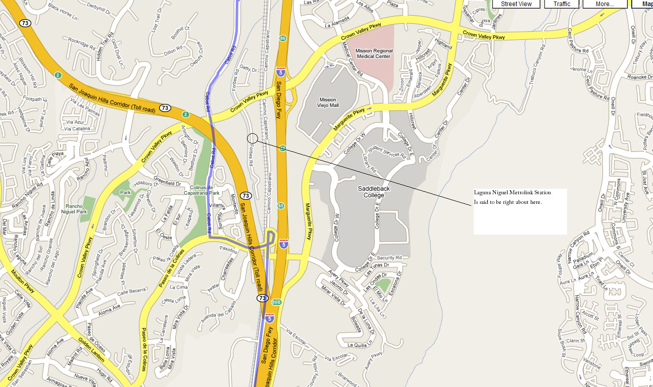
Laguna Niguel Amtrak
Trains Depart: 8:35 AM (confirm via Amtrak schedule)
See map for directions
25. Slight right to stay on Cabot Rd - 0.3 mi
26. Turn left at Paseo de la Colinas - 0.4 mi
27. Turn left at Camino Capistrano - 4.1 mi
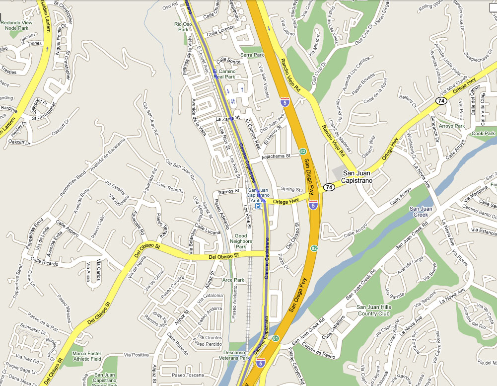
San Juan Capistrano Amtrak
Trains Depart: 8:28, 10:49, 11:55, 1:21, etc (confirm via Amtrak schedule)
See map for directions
26701 Verdugo Street
San Juan Capistrano, CA 92675
28. Slight right to stay on Camino Capistrano - 1.8 mi
29. Slight left to stay on Camino Capistrano - 0.1 mi
30. Continue on Doheny Park Rd - 0.6 mi
31 a. Continue on El Camino Real - approx 4.0 mi
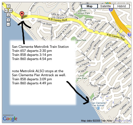
San Clemente Metrolink
Trains Depart: 2:30, 3:14, and 4:54 PM (confirm via Metrolink schedule)
It's right along the route, and will likely be marked.
See map for directions
San Clemente Pier Amtrak
Trains Depart: 4:11, 5:15 PM (confirm via Amtrak schedule)
615 Avenida Victoria
at the San Clemente Pier
San Clemente, CA 92672
See map for directions
San Clemente Pier Metrolink
Trains depart 3:09, and 4:49 pm
See map for directions
31 b. Continue on El Camino Real - 3.2 mi
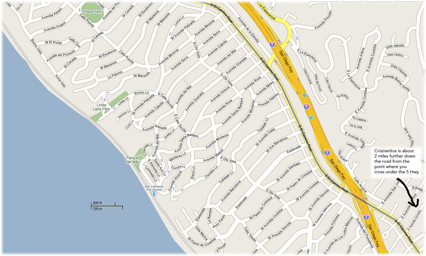
Rest Stop - 19.3 Miles, Cumulative - 41.3 Miles (Map Link)
Cristianitos, Carls Jr Parking Lot
32. Head southeast on S El Camino Real toward Cristianitos Rd - 492 ft
33. Turn right at Cristianitos Rd - 0.2 mi
34. Turn left toward Old Hwy 101/Old Pacific Hwy - 1.1 mi
35. Turn right at Old Hwy 101/Old Pacific Hwy - 7.7 mi
36. Slight right to stay on Old Hwy 101/Old Pacific Hwy - 1.5 mi
37. Turn left at El Camino Real - 0.3 mi
38. Slight right at Las Pulgas Rd/Las Pulgas Canyon Rd Continue to follow Las Pulgas Rd - 0.5 mi
39. Slight right at Stuart Mesa Rd - 0.8 mi
40. Turn right toward Stuart Mesa Rd - 1.7 mi
41. Turn right at Stuart Mesa Rd - 4.0 mi
42. Turn right toward Vandegrift Blvd - 1.0 mi
43. Slight right at Vandegrift Blvd - 0.3 mi
44. Slight right to stay on Vandegrift Blvd - 0.3 mi
45. Continue on Harbor Dr - 0.3 mi
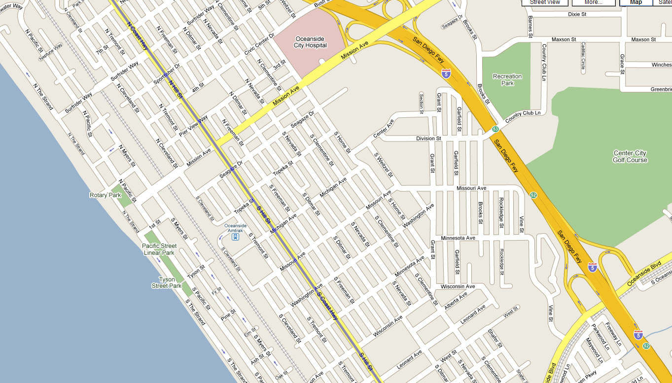
46. Turn left at N Hill St/S21 Continue to follow S21 - 3.7 mi
Oceanside Amtrak
Trains Depart: 10:18 & 11:25 AM, 12:49, 1:44, 3:50, 4:52, 6:10, 7:10, 9:09, 10:04 PM
235 S. Tremont Ave.
Oceanside, CA 92054
See map for directions
47. Slight right at Carlsbad Blvd/S21 - 3.2 mi
48. Slight left to stay on Carlsbad Blvd/S21 - 3.1 mi
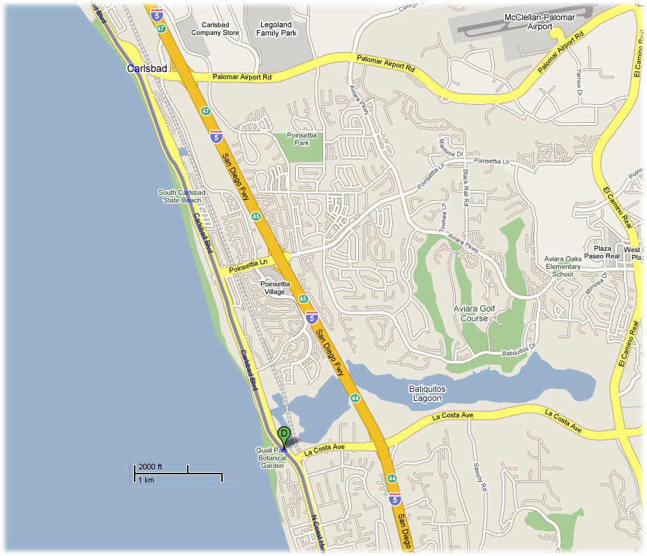
Rest Stop - 29.7 Miles, Cumulative - 71 Miles (Map Link)
Quail Park Botanical Garden (just south of Carlsbad)
49. Head southeast on Carlsbad Blvd/S21 toward La Costa Ave Continue to follow S21 - 2.6 mi
50. Slight right at 1st St/S21 Continue to follow S21 - 1.9 mi
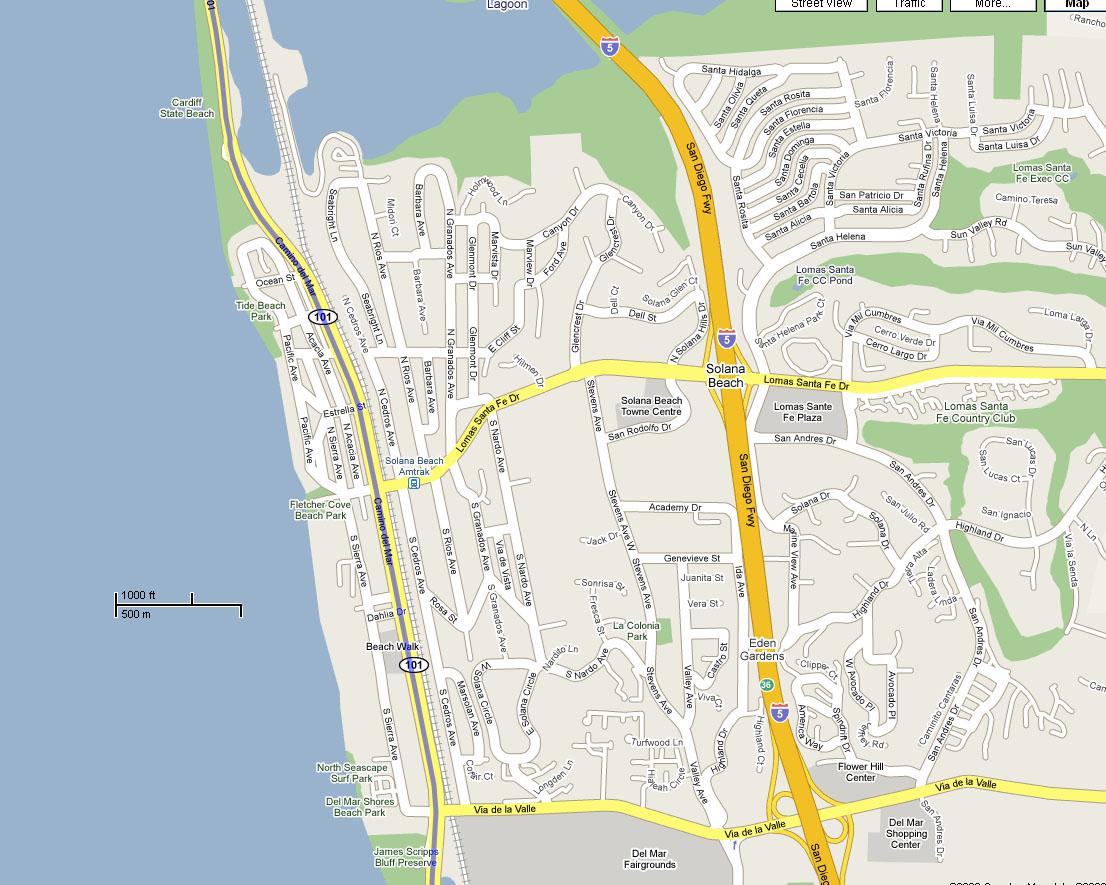
51. Slight left to stay on S21 - 9.7 mi
Solana Beach Amtrak
Trains Depart: 10:04 & 11:09 AM, 12:34, 1:29, 3:34, 4:35, 5:56, 6:56, 8:54, and 9:49 PM (confirm via Amtrak schedule)
105 North Cedros Avenue
Solana Beach Transit Center
Solana Beach, CA 92075
See map for directions
52. Turn right at N Torrey Pines Rd - 1.2 mi
53. Turn left at La Jolla Shores Dr - 154 ft
54. Turn right at Scholars Dr S - 0.6 mi
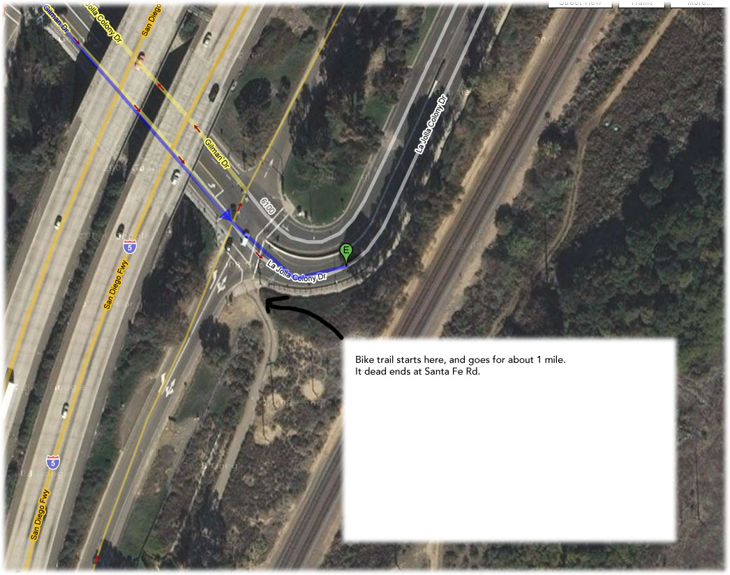
55. Turn right at Gilman Dr - 1.8 mi
56. Continue on La Jolla Colony Dr - 161 ft
Arrive at: La Jolla Colony Dr |